By Car
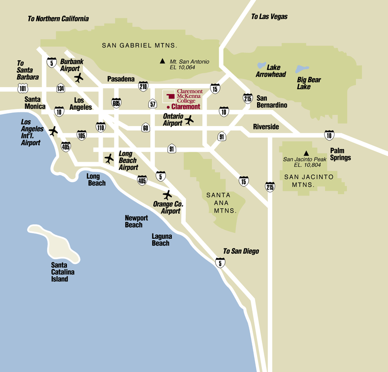
From the Los Angeles area, take the San Bernardino Freeway (I-10) west to Indian Hill Boulevard (Exit 47). Drive north on Indian Hill for about two miles. Turn right onto 6th Street, then left onto College Way. Keep right at the split in the road then turn left onto Columbia Avenue and the Kravis Center will be to your right. There is available parking directly west of the building.
From Pasadena and the San Fernando Valley, take the Foothill Freeway (I-210) east. Exit at Towne Avenue and drive south for one mile. Turn left onto Foothill Boulevard and continue until you reach Dartmouth Boulevard. Turn right onto Dartmouth Boulevard. Turn left at the stop sign and take your next immediate left. The Kravis Center will be on your left on Columbia Avenue.
From Orange County, take the Orange Freeway (Route 57) north to the San Bernardino Freeway (I-10). Continue east on I-10 to Indian Hill Boulevard (exit 47). Drive north on Indian Hill for about two miles. Turn right onto 6th Street, then left onto College Way. Keep right at the split in the road then turn left onto Columbia Avenue and the Kravis Center will be to your right. There is available parking directly west of the building.
By Air
Claremont is located about 10 miles west of Ontario International Airport (ONT). Other airports in the region include Los Angeles International (LAX), John Wayne/Santa Ana (SNA), Burbank (BUR) and Long Beach (LGB). Each is between 30-50 miles from Claremont.
By Train
The closest Amtrak station is in Pomona, a few miles from the campus. Claremont is served from Los Angeles by Metrolink. The station is south of campus.